
Hunsaker & Associates Irvine, Inc.’s mapping and field survey crews have many years of experience with all phases of surveying, involving hundreds of projects throughout the Southwestern United States. Some of these projects include legal research and documentation as well as specialized surveying for aerial control, construction and environmental staking and transportation boundary and property records. Both the public and private sectors have benefited by the accuracy of H&A’s professionally licensed land surveyors on residential, commercial, industrial, public works, and military projects.
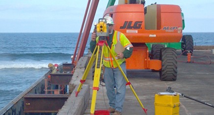
Field Surveying Services
Our field survey crews are fully supported by a team of licensed surveyors in the office. Our office support team provides most of the field calculations for the survey crews. This eliminates potential problems and construction delays. The result is a savings of time and money for our clients by enabling our survey crews to begin staking immediately upon arrival to the job site.
Each field crew is supplied with a laptop computer equipped with CAD to complement the survey calculations supplied by the office support team. Our survey crews are also provided with proprietary programs and spreadsheets designed to perform everyday surveying tasks with the highest degree of accuracy and efficiency. All computers have wireless broadband internet service for sharing data with our office and consultants. In addition, each Party Chief is equipped with a Smartphone. We utilize current industry standard sophisticated terrestrial and geospatial survey equipment, including the use of multiple Real Time networks
Our full-service field surveying department has produced countless boundary surveys, monumentation tie-outs/perpetuations, horizontal and vertical control networks, detailed site cultural surveys and roadway cross-sectioning for design survey base mapping, determination of vertical datums for projects and as-built improvements documentation surveys. H&A has provided construction/ infrastructure staking for the majority of projects designed by our firm and for numerous Contractors’ and agencies construction project sites. H&A survey projects cover the full spectrum of public works and private section projects including street, bridge, sewer, water, storm drain facilities, flood control channel improvements, dry utilities facilities, and intricate commercial plant and buildings complexes of all types.
H&A has thorough knowledge of, and our survey work will comply with all applicable City/County/Caltrans Safety guidelines, local and State laws and requirements including Cal/OSHA, Title 8 and Caltrans WATCH manual. H&A’s professional surveying services integrate proven quality control and safety procedures that have been successfully developed over our firm’s long history. Our surveying/mapping staff is keenly aware of the key role surveying plays in successfully completing a construction project. At H&A, we understand the importance of teamwork, accuracy and responsiveness to the client’s time and budgetary constraints. All of our crews are Haz-Mat Certified.
Our Field Survey services include:
- Aerial Control Surveys
- Boundary & Property Surveys
- Boundary Staking
- Constructibility Analysis
- Construction Staking
- Environmental Staking
- Field Design Surveys
- Geodetic Control Surveys
- GIS/LIS Surveys
- GPS/RTK Surveys
- High-rise Control & Layout
- Hydrographic Surveys
- Monumentation Surveys
- Records of Survey
- Right-of-way Engineering
- Right-of-way Staking
- Settlement Monitoring
- Site Resource Surveys
- Topographic Surveys
- Utilities Staking
- Vertical Control
Mapping Services
The H&A office support survey/mapping department is familiar with all Southern California City and County mapping requirements as well as Caltrans right-of-way checking procedures, title/encumbrances analysis, and the Subdivision Map Act requirements. All of H&A’s equipment, both office and field surveying, is continually updated to the highest level of industry technology standards/capabilities.
Our Mapping services include:
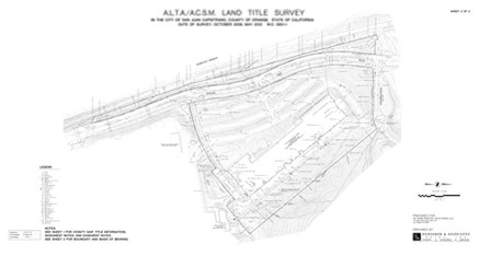
- A.L.T.A. Surveys
- Boundary/Property Survey
- Complex Boundary Surveys
- Encumbrance Mapping
- Field Reconnaissance To Locate Record Monuments
- Land Conveyance Exhibits
- Legal Descriptions and Sketches
- Lot Line Adjustments
- Plan Checking
- Right-of-way Acquisition Exhibits
- Records of Survey
- Title Research/Reports
- Tract Map Preparation